

Литература по ESRI ArcGIS |
Здравствуйте, гость ( Вход | Регистрация )
| Here You Can Support Our Work and .:LavTeaM:. Services |
  |
Литература по ESRI ArcGIS |
 17.07.2015 - 01:50 17.07.2015 - 01:50
Сообщение
#21
|
|
 Свой человек  Группа: Пользователи Пользователь №: 102276 Сообщений: 531 Регистрация: 8.12.2008 Загружено: байт Скачано: байт Коэффициент: --- Спасибо сказали: 1396 раз(а) |
Programming ArcGIS 10.1 with Python Cookbook
Over 75 recipes to help you automate geoprocessing tasks, create solutions, and solve problems for ArcGIS with Python Eric Pimpler hXXps://mega.co.nz/#!okd2HJBJ!gkV3zK9U6lvNjfuDiePUIycJ7yrc1uOh69kv7ZjRpwo Сообщение отредактировал GK.000 - 17.07.2015 - 01:53 |

|

 
|
|
17.07.2015 - 15:05
Сообщение
#22
|
|
|
Из местных Группа: Пользователи Пользователь №: 159372 Сообщений: 96 Регистрация: 19.02.2013 Из: Philippines Загружено: байт Скачано: байт Коэффициент: --- Спасибо сказали: 10 раз(а) |
Thanks for this book. Have you also the the example code for this book
|
|
|
|
|
17.07.2015 - 21:24
Сообщение
#23
|
|
|
Свой человек Группа: Пользователи Пользователь №: 102276 Сообщений: 531 Регистрация: 8.12.2008 Загружено: байт Скачано: байт Коэффициент: --- Спасибо сказали: 1396 раз(а) |
to rac here is example code for this book
  Programming ArcGIS 10.1 with Python Cookbook.zip 140.0 MB Published 2013-02-22 https://mega.co.nz/#!N0lwkJSI!pDnYfjVCtF_z8BBtUunBlAUdu-PiEkYfF2iu-yYzgcI ERRATA (an error in printing or writing) file attached Сообщение отредактировал GK.000 - 17.07.2015 - 21:30
Прикрепленные файлы
|
|
|
|
|
7.08.2015 - 18:16
Сообщение
#24
|
|
 Живущий здесь  Группа: Админы Пользователь №: 97235 Сообщений: 6681 Регистрация: 6.10.2008 Загружено: байт Скачано: байт Коэффициент: --- Спасибо сказали: 7674 раз(а) |
Essential Earth Imaging for GIS
by Lawrence Fox III Paperback: 128 pages Published: 2015 ISBN: 9781589483453 eISBN: 9781589484313 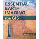 Приватный текст
|
|
|
|
|
17.10.2015 - 02:23
Сообщение
#25
|
|
|
Свой человек Группа: Пользователи Пользователь №: 102276 Сообщений: 531 Регистрация: 8.12.2008 Загружено: байт Скачано: байт Коэффициент: --- Спасибо сказали: 1396 раз(а) |
Programming ArcGIS with Python Cookbook Second Edition, July 2015
EBOOK & CODE hXXps://mega.nz/#!Iwsj0ZCA!jeWGdHM-2v1M6El3OtIDHseW3t0g53KyLSAI_eM38UM hXXps://mega.nz/#!c1METB4b!ZbwQGrs8dY97qaFsZ2bPsOBiAYilSqwNBlNEXNRSaW0 |
|
|
|
|
3.11.2015 - 11:28
Сообщение
#26
|
|
|
Новичок Группа: Пользователи Пользователь №: 33537 Сообщений: 4 Регистрация: 5.05.2006 Загружено: байт Скачано: байт Коэффициент: --- Спасибо сказали: 0 раз(а) |
Всем присутствующим привет! Огромная просьба поделиться официальными учебниками по курсам ESRI ArcGIS 1: Введение в ГИС, ArcGIS 2: Основные рабочие процессы, ArcGIS 3: Выполнение анализа с учебными материалами для ArcGIS 10.1 или 10.2. Все, что нашел в сети - под девятые версии и многие упражнения на 10-й версии не получаются. Заранее благодарен!
|
|
|
|
|
5.11.2015 - 14:00
Сообщение
#27
|
|
|
Новичок Группа: Пользователи Пользователь №: 33537 Сообщений: 4 Регистрация: 5.05.2006 Загружено: байт Скачано: байт Коэффициент: --- Спасибо сказали: 0 раз(а) |
Цитата(tracer78 @ 3.11.2015 - 14:28)  Всем присутствующим привет! Огромная просьба поделиться официальными учебниками по курсам ESRI ArcGIS 1: Введение в ГИС, ArcGIS 2: Основные рабочие процессы, ArcGIS 3: Выполнение анализа с учебными материалами для ArcGIS 10.1 или 10.2. Все, что нашел в сети - под девятые версии и многие упражнения на 10-й версии не получаются. Заранее благодарен! Все еще актуально |
|
|
|
|
24.06.2016 - 13:50
Сообщение
#28
|
|
|
Новичок Группа: Пользователи Пользователь №: 155490 Сообщений: 15 Регистрация: 19.08.2012 Загружено: байт Скачано: байт Коэффициент: --- Спасибо сказали: 5 раз(а) |
I think it's useful and your job is excellent. Many thanks
|
|
|
|
|
20.11.2016 - 10:30
Сообщение
#29
|
|
 Торговец чёрным деревом Группа: Админы Пользователь №: 3953 Сообщений: 21844 Регистрация: 1.08.2003 Из: Москва Загружено: байт Скачано: байт Коэффициент: --- Спасибо сказали: 55825 раз(а) |
Lynda ArcGIS Pro Essential Training Tutorial
 Get data-mapping and geoprocessing power in a new, more intuitive work environment with ArcGIS Pro. ArcGIS Pro Essential Training shows how to use the new ribbon-based interface and editing environment in ArcGIS to accomplish common 2D and 3D mapping tasks. Learn to create project-centered files that gather local and online resources and geodatabases together into a single location making management and creation of your maps that much easier. Create multiple 2D map views and 3D scenes in a single project and save project templates to reuse your layouts. Instructor Adam Wilbert also covers manipulating data using the included ArcGIS geoprocessing tools, adding styles and symbols, and sharing the final maps via ArcGIS Online or as standalone packages.  1, 2. 1, 2.1.05 Gb (RAR5, incl. 3% - info for restoration purpose) |
|
|
|
|
22.01.2018 - 20:06
Сообщение
#30
|
|
|
Свой человек Группа: Пользователи Пользователь №: 102276 Сообщений: 531 Регистрация: 8.12.2008 Загружено: байт Скачано: байт Коэффициент: --- Спасибо сказали: 1396 раз(а) |
The Ins and Outs of ArcGIS Data Analysis [Video Author Kyle Walker
Video Details ISBN 139781788396219 Course Length2 hours and 24 minutes What You Will Learn Work with XY data and coordinate systems in ArcMap Spatially analyze data using functions in ArcGIS Toolbox Edit sessions and features in ArcMap Georeference different image datasets in ArcMap Create a new feature class for your project Spatially analyze your raster and vector data in ArcMap Perform surface analysis such as slopes, aspects, and viewsheds Authors Kyle Walker Table of Contents SPATIAL DATA ANALYSIS The Course Overview Coordinate Systems and Map Projections – The Basics Working with XY Data and Coordinate Systems in ArcMap Exploring Relationships Between Datasets with Vector Overlay Exploring Spatial Analysis Principles Spatial Analysis Functions in ArcToolbox Point Pattern Analysis CREATING YOUR OWN DIGITAL DATA Diving into Geodatabases in ArcGIS Editing Sessions and Editing Features in ArcMap Georeferencing Images in ArcMap Creating a New Feature Class Digitizing Features in ArcMap RASTER SPATIAL ANALYSIS Raster Data –Core Principles Reclassifying Rasters in ArcMap Raster Overlay in ArcMap Spatial Analysis with Raster and Vector Data Surface Analysis –Slope, Aspect, and Viewsheds ====mediafire=== » Click to show Spoiler - click again to hide... «
ArcGIS Essential Training+Exercise Files Adam Wilbert Released10/22/2014 Learn to create and manage data, maps, and analytical models with ArcGIS. Author Adam Wilbert shows how to get around maps and start adding your own data and importing data from existing databases. He demonstrates how to select and edit individual map elements, and connect to advanced geospatial data sources. He explains the finer points of working with vector vs. raster data, and then shows how to style your map so it's easy for others to interpret, including finishing touches such as a legend, scale bar, and annotations. Plus, learn how to use ModelBuilder to sequence workflows and share them with the rest of your organization. Topics include: Getting to know the ArcMap interface Geocoding addresses Measuring distances Adding and importing data Labeling and adding graphs Editing layer properties Seeing multiple views Making selections Exploring geospatial data with ArcCatalog Working with vector and raster data Styling the map Adding your own data Using the ModelBuilder Adding a legend and annotations ========mediafire===== » Click to show Spoiler - click again to hide... «
Сообщение отредактировал GK.000 - 22.01.2018 - 20:06 |
|
|
|
|
23.01.2018 - 15:17
Сообщение
#31
|
|
|
Свой человек Группа: Пользователи Пользователь №: 102276 Сообщений: 531 Регистрация: 8.12.2008 Загружено: байт Скачано: байт Коэффициент: --- Спасибо сказали: 1396 раз(а) |
Spatial Analytics with ArcGIS by Eric Pimpler  data files included /mediafire/ » Click to show Spoiler - click again to hide... «
Сообщение отредактировал GK.000 - 23.01.2018 - 15:23 |
|
|
|
|
25.01.2018 - 06:24
Сообщение
#32
|
|
|
Торговец чёрным деревом Группа: Админы Пользователь №: 3953 Сообщений: 21844 Регистрация: 1.08.2003 Из: Москва Загружено: байт Скачано: байт Коэффициент: --- Спасибо сказали: 55825 раз(а) |
Eric Pimpler - Spatial Analytics with ArcGIS
with training data files Packt Publishing, 2017 pdf, 285 pages, english ISBN: 978-1-78712-258-1 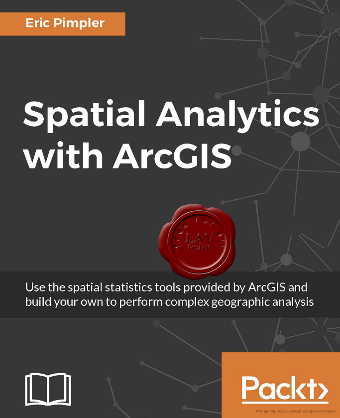 Spatial statistics has the potential to provide insight that is not otherwise available through traditional GIS tools. This book is designed to introduce you to the use of spatial statistics so you can solve complex geographic analysis. The book begins by introducing you to the many spatial statistics tools available in ArcGIS. You will learn how to analyze patterns, map clusters, and model spatial relationships with these tools. Further on, you will explore how to extend the spatial statistics tools currently available in ArcGIS, and use the R programming language to create custom tools in ArcGIS through the ArcGIS Bridge using real-world examples. At the end of the book, you will be presented with two exciting case studies where you will be able to practically apply all your learning to analyze and gain insights into real estate data. What you will learn: - Get to know how to measure geographic distributions - Perform clustering analysis including hot spot and outlier analysis - Conduct data conversion tasks using the Utilities toolset - Understand how to use the tools provided by the Mapping Clusters toolset in the Spatial Statistics Toolbox - Get to grips with the basics of R for performing spatial statistical programming - Create custom ArcGIS tools with R and ArcGIS Bridge - Understand the application of Spatial Statistics tools and the R programming language through case studies link.76 Mb (RAR5, incl. 3% - info for restoration purpose) |
|
|
|
|
5.02.2018 - 19:04
Сообщение
#33
|
|
|
Свой человек Группа: Пользователи Пользователь №: 102276 Сообщений: 531 Регистрация: 8.12.2008 Загружено: байт Скачано: байт Коэффициент: --- Спасибо сказали: 1396 раз(а) |
GIS Tutorial 1 for ArcGIS Pro: A Platform Workbook, first edition
 by Wilpen L. Gorr, Kristen S. Kurland Paperback and Electronic: 470 pages Published: 2017 ISBN: 978-1-58948-466-5 eISBN: 978-1-58948-493-1 File format: epub » Click to show Spoiler - click again to hide... «
|
|
|
|
|
5.02.2018 - 19:30
Сообщение
#34
|
|
|
Свой человек Группа: Пользователи Пользователь №: 102276 Сообщений: 531 Регистрация: 8.12.2008 Загружено: байт Скачано: байт Коэффициент: --- Спасибо сказали: 1396 раз(а) |
The GIS 20: Essential Skills  The GIS 20: Essential Skills, third edition, updated for ArcGIS Desktop® 10.6, presents step-by-step instructions, illustrations, and practical tips on how to perform the top 20 skills needed to successfully use a geographic information system (GIS). These skills include finding and editing data, querying GIS maps, creating reports, and sharing and publishing maps. File format: Epub » Click to show Spoiler - click again to hide... «
Сообщение отредактировал GK.000 - 5.02.2018 - 19:34 |
|
|
|
|
5.02.2018 - 23:00
Сообщение
#35
|
|
|
Свой человек Группа: Пользователи Пользователь №: 102276 Сообщений: 531 Регистрация: 8.12.2008 Загружено: байт Скачано: байт Коэффициент: --- Спасибо сказали: 1396 раз(а) |
Understanding GIS, third edition  by David Smith, Nathan Strout, Christian Harder, Steven Moore, Tim Ormsby, Thomas Balstrøm Paperback and Electronic: 360 pages Published: 2017 ISBN: 9781589484832 eISBN: 9781589484955 Updated for the third edition using ArcGIS® Pro software, Understanding GIS: An ArcGIS® Pro Project Workbook is the first textbook on the market to teach how to use real-world data to develop a GIS project, from start to finish. This book lets you assume the role of a GIS analyst challenged with finding the best location for a new park along the Los Angeles River in Southern California. The book provides the starting data and guidance for using ArcGIS Pro software to perform a complete GIS analysis, map the findings, and share the results on interactive web maps. file format azw3 & pdf (conv) » Click to show Spoiler - click again to hide... «
|
|
|
|
|
6.02.2018 - 02:03
Сообщение
#36
|
|
|
Свой человек Группа: Пользователи Пользователь №: 102276 Сообщений: 531 Регистрация: 8.12.2008 Загружено: байт Скачано: байт Коэффициент: --- Спасибо сказали: 1396 раз(а) |
Learning ArcGIS Pro  ISBN-10: 1785284495 ISBN-13: 9781785284496 Language: English Pages: 300 PDF+CODE » Click to show Spoiler - click again to hide... «
Сообщение отредактировал GK.000 - 8.02.2018 - 00:57 |
|
|
|
|
11.04.2018 - 00:41
Сообщение
#37
|
|
|
Новичок Группа: Пользователи Пользователь №: 186441 Сообщений: 15 Регистрация: 13.10.2016 Загружено: байт Скачано: байт Коэффициент: --- Спасибо сказали: 4 раз(а) |
Thank you I was looking for some literature on ArcGIS spatial analysis.
|
|
|
|
|
21.06.2019 - 07:03
Сообщение
#38
|
|
|
Торговец чёрным деревом Группа: Админы Пользователь №: 3953 Сообщений: 21844 Регистрация: 1.08.2003 Из: Москва Загружено: байт Скачано: байт Коэффициент: --- Спасибо сказали: 55825 раз(а) |
David Smith, Nathan Strout - Understanding GIS: An ArcGIS Pro Project Workbook, 4th Edition
Esri Press, 2018 pdf, 378 pages, english ISBN-13: 978-1589482425 ISBN-10: 1589482425  The first single-project GIS textbook on the market, Understanding GIS: An ArcGIS Pro Project Workbook, fourth edition is an excellent resource for students and educators seeking a guide for an advanced, single-project-based course that incorporates GIS across a wide range of disciplines. It allows readers to progress through nine lessons using ArcGIS Pro software from Esri to find the best location for a new park along the Los Angeles River in Southern California. Each exercise offers step-by-step instructions, graphics to confirm exercise results, and explanations of key concepts. The book includes access to ArcGIS Desktop software, which includes ArcGIS Pro. Project data (real data, all of it updated) is downloadable from the book's resource web page. https://turbobit.net/ojrtxhym1cbe.html |
|
|
|
|
26.06.2020 - 08:55
Сообщение
#39
|
|
|
Торговец чёрным деревом Группа: Админы Пользователь №: 3953 Сообщений: 21844 Регистрация: 1.08.2003 Из: Москва Загружено: байт Скачано: байт Коэффициент: --- Спасибо сказали: 55825 раз(а) |
Michael Law, Amy Collins - Getting to Know ArcGIS Pro
ESRI, 2016 epub, 450 pages, english ISBN-13: 978-1-589-48457-3 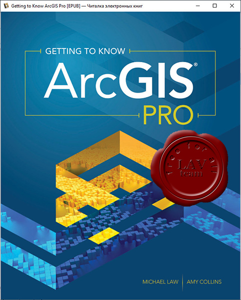 In the tradition of the best-selling Getting to Know series,Getting to Know ArcGIS Proteaches new and existing GIS users how to get started solving problems by visualizing, querying, creating, editing, analyzing, and presenting geospatial data in both 2D and 3D environments using the latest ArcGIS mapping app, ArcGIS Pro. This book teaches the basic functions and capabilities of ArcGIS Pro through practical project workflows and shows how it is an essential component of the ArcGIS platform. Data for completing the exercises and trial software are available for download: https://esripress.esri.com/bookResources/index.cfm?event=catalog.book&id=20 link.70 Mb (RAR5, incl. 3% - info for restoration purpose) |
|
|
|
|
29.07.2020 - 17:41
Сообщение
#40
|
|
|
Торговец чёрным деревом Группа: Админы Пользователь №: 3953 Сообщений: 21844 Регистрация: 1.08.2003 Из: Москва Загружено: байт Скачано: байт Коэффициент: --- Спасибо сказали: 55825 раз(а) |
Wilpen Gorr, Kristen Kurland - GIS Tutorial 1 for ArcGIS Pro 2.4: A Platform Workbook (GIS Tutorials), 2 Edition
ESRI, 2020 epub, 702 pages, english e-ISBN: 978-1-589-48590-7  GIS Tutorial 1 for ArcGIS Pro: A Platform Workbook is an introductory text for learning ArcGIS Pro, the premier professional desktop GIS application. In-depth exercises that use ArcGIS Pro, ArcGIS Online, and other ArcGIS apps show readers how to make maps, how to create and analyze spatial data, and how to manage systems with GIS. GIS Tutorial 1 for ArcGIS Pro: A Platform Workbook engages readers in: - Obtaining spatial data and building a geodatabase for collecting, editing, and processing data - Exploring the functionalities of ArcGIS Pro, ArcGIS Online, and apps; understanding the elements of map design; and creating map layouts, story maps, dashboards, and 3D maps - Analyzing spatial data using buffers and street network-based service areas, locating facilities, and conducting cluster analysis - Automating GIS through macros for monitoring and optimal routing of service deliveries with data input in the field using a mobile app - Carrying out real-world applications for health care, crime, government services, planning, and marketing. Incorporating proven teaching methods in detailed exercises, "Your Turn" sections, and expanded homework assignments, GIS Tutorial 1 for ArcGIS Pro: A Platform Workbook is suited to learning GIS in a classroom. Wilpen Gorr and Kristen Kurland have written the top-selling GIS Tutorial 1: Basic Workbook, GIS Tutorial for Health, and GIS Tutorial for Crime Analysis. link.41 Mb (RAR5, incl. 3% - info for restoration purpose) |
|
|
|
|

|
Текстовая версия | Сейчас: 19.04.2024 - 22:58 |


